


- St. Mary, Montana lies on the eastern edge of Glacier National Park
- Easily access Going to the Sun Highway and drive right through the middle of the park
- Two Medicine, Many Glacier and Lake McDonald
- In early July, don’t miss the North American Indian Days and Pow Wow
Overview
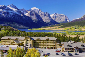
St. Mary is the access point to the Going to the Sun Highway, which bisects Glacier National Park. Only a mile from the park’s interior and incredible sights, St. Mary is the ideal location for a home base on your Glacier vacation. The views from this mountain town will almost match what you’ll experience in Glacier so you shouldn’t miss a stop here.
Location
Saint Mary is on US Highway 89 in northwestern Montana, between Upper St. Mary Lake, within Glacier National Park, and Lower St. Mary Lake on the Blackfoot Indian Reservation.
Services/Amenities
St. Mary is a small town but you’ll find delicious food that will give you the energy you need for your daily adventures. There are cafes with American cuisine, a pizza place and a grill. You’ll enjoy grabbing a bite in St. Mary.
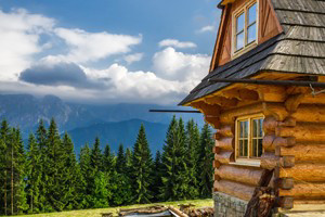
You’ll find accommodations that will suit any need in St. Mary. Discover the comfort of a cozy cabin, a luxury cottage or a standard motel. Most will provide you with wonderful views.
Activities
- Hiking
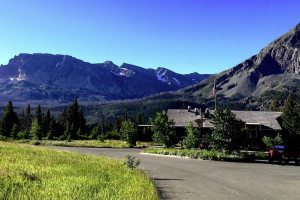
From St. Mary you’ll have access to hiking trails, long and short. For a long day hike or an adventurous overnighter, try the Granite Park Trail. Although this trek can be nerve-racking as it moves along a ledge, it gives you some unique views of the peaks surrounding. Anywhere in Glacier National Park you’ll discover multiple choices for great hikes. Some popular areas are Two Medicine, Many Glacier and Lake McDonald. - Rafting
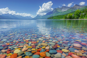
If you haven’t brought your own, you can rent a canoe or kayak to explore the Lower St. Mary Lake, Lake McDonald or the St. Mary River. Boat ramps are available on the lakes, and you can also carry your boat to smaller waters. - Fishing
Cast a line into Lower St. Mary Lake for a day of fishing. You’ll enjoy the experience of fishing with breathtaking scenery as a backdrop to your adventure. - Boat Tours
For a relaxing tour, try a scenic boat excursion. As you cruise St. Mary Lake, you get the spectacular views as well as some interesting narrated talks. Some cruise boats will stop for photographic opportunities. - Camping
For a little roughing it around Glacier, you can camp at any of the campgrounds on the east side of the park. There’s nothing quite as thrilling as sleeping out under the stars around St. Mary, Montana.
Attractions
- Going-to-the-Sun Highway
This is the 52-mile highway that crosses Glacier National Park and passes through every sort of terrain imaginable. Driving this route is the only way to really experience the park’s spectacular beauty. - Waterton International Peace Park
Only 40 minutes away is the Waterton-Glacier International Peace Park where you can move into Canada and see this incredible park from both sides of the border. - North American Indian Days and Pow Wow
If you are in St. Mary in early July, don’t miss the North American Indian Days and Pow Wow where you will have the special opportunity to get the real flavor of the early days in our history.
Getting Here
To get to the interior of Glacier National Park, start out on US Highway 89 west to the Going to the Sun Highway. It’s only a mile from the center of St. Mary.

